BACK TO TOP
MAPS & PLANS
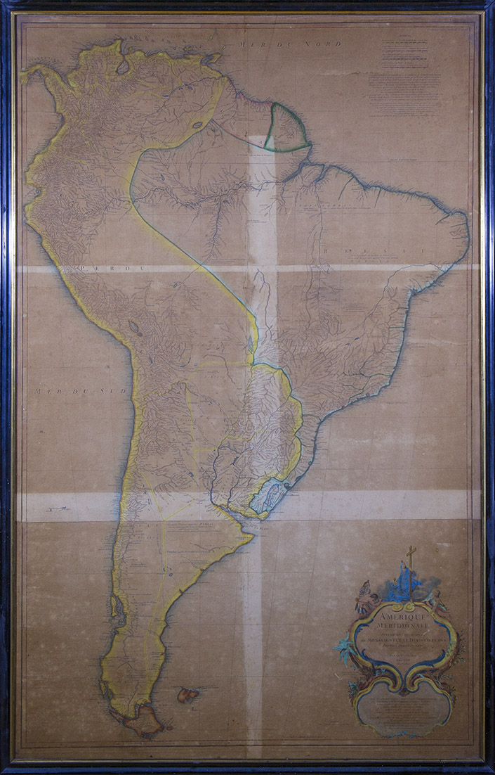
Amérique Méridionale (...). 1748.
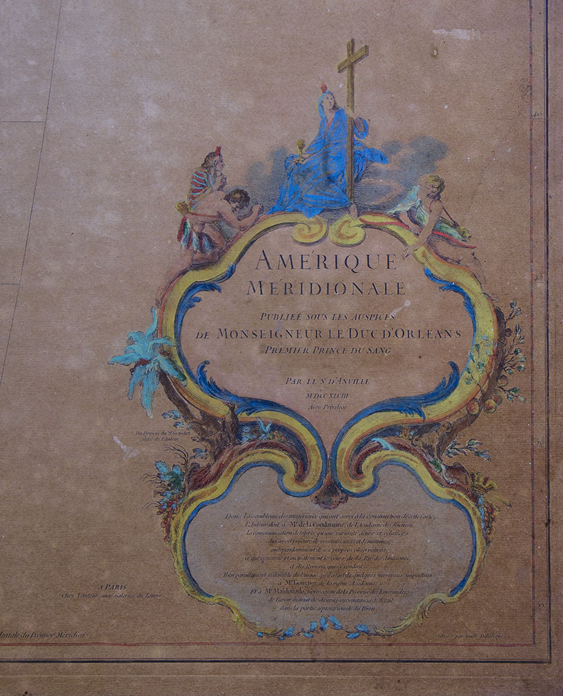
Amérique Méridionale publiée sous les Auspices de Monseigneur le Duc dOrléans Premier Prince du Sang. Par Le Sr. dAnville. MDCCXLVIII (1748).
Large map, hand colored and lined. Measurements: 128 x 72 cm / 50.39 x 28.34 in. Work in good condition but with oxidation. With its old frame.
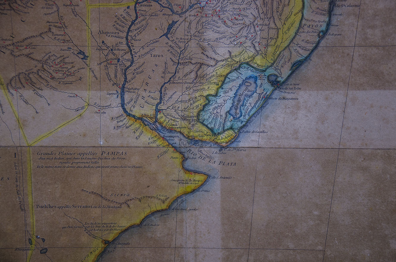
This map was part of the Atlas or Cartes Géographiques, edited by Bourguignon d'Anville himself. With profusion of geographic details, it has data on the native peoples of our region, for example, we read: "Pehuenches, who are from the Auca nation", "Puelches called Tuelchus or southern", "Puelches called Serranos or mountain", " Great Plains called Pampas, from an Indian word, which in the Quichua language of Peru means Valley itself, and the same name is given to the Indians who live wandering through their plains. Designed by Hubert Franco̧ is Gravelot (1699-1773) and engraved by Guillaume Delahaye, it presents an elegant cartouche, with three natives kneeling before a Christian female allegory. There we read that d'Anville availed himself of Mr. de la Condamine, Mr. Bourguer, both academics of the Academy of Sciences, and Mr. Maldonado, Governor of the Emeraudes provinces, who instructed him in various details of Peru.
Its author, Jean Baptiste Bourguignon d'Anville (Paris, 1697-1782), was a French geographer and cartographer. On his maps, unlike his contemporaries, he left unknown areas blank. Appointed royal geographer in 1718, when he was barely twenty-two years old, he produced throughout his life numerous treatises on geography and 211 maps that are considered the best of their time for their great precision.
S.H.O-X-IMM
| AUTHOR | BOURGUIGNON DANVILLE, J. B. |
|---|
Are you interested in selling some works?
Send us an email briefly indicating
which works you intend to put on sale, and we will respond. click here
Subscribe to our newsletter to be updated.
Check our Newsletters